At Jones Road (unmarked), we turned off the highway and followed a dirt road about .4 mi. to the Lincoln Mountain Open Space TH.
 |
| Douglas County spared no expense for sinage. |
History: The area was formerly known as the Palmer Divide Ranch on West Cherry Creek. It was a cattle ranch for many years. Douglas County acquired a number of parcels and now offers visitors 876 acres to enjoy.
In July, 2012, a crew from Arrowhead Trails Inc., based in Salida, Colorado, began developing a 6.5 mi. trail system at Lincoln Mountain Open Space. The firm has been specializing in the design, construction, and management of shared use trails in ten states since 1994. Based on what we experienced on this hike, they did a fine job.
The large gravel parking area at the TH is surrounded by a buck and rail log fence, giving the space a back country feel. A Port-A-John is the only facility. The trail system is displayed on a large trail marker. Unfortunately. all the Open Space maps were gone today.
We began the day on a short .3 mi. spur trail that led to a junction with the 4.5 mile Palmer Divide Ranch Loop Trail, and the 4.2 mile Lincoln Mountain Loop Trail. The one undeniable feature that would be in numerous images taken today,is that of a snow covered Pikes Peak. Within the first mile on trail, we stop to shed one layer for comfort. A baby black snake, soaking in the sun on trail, darted off into the grass as we arrived at it's previously private spot.
 |
| Ed and Judy on Palmer Divide Ranch Trail. |
 |
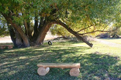
| One of two huge willows with tire swing. |
Trail then drops back into the grassland before coming to the end of the loop. A short distance beyond that, we are at the junction of the Lincoln Mountain Loop Trail. This 4.2 mile loop takes hikers on a 400' climb, through Gamble Oak and Ponderosa Pine to the top of Lincoln Mountain.
 |
| Looking east from atop Dewey's Hill. |
Trail becomes a bit more rocky as it makes a series of squiggly switchbacks while gaininng elevation. Still not much to boast about scenery except for the forever obvious Pikes Peak not far to the southwest
As we make our way to the top of Lincoln Mountain, we can see a pickup pulling a horse trailer has parked at the TH. The sun remains a good friend to us as it beams its warm rays from near cloudless skies. A second black snake darted across trail.
 |
| Ed and Judy clear a wilow thicket. |
Now close to mid-day we decide to stop for lunch beside trail just after completing about half of the loop. A light breeze doesn't keep me from setting up the backpackers stove. My day pack leans against my leg serving as a somewhat effective windscreen.
 |
| Why would we need to "Slow Down" on this trail? |
Back on trail to complete the loop and return to the TH. A few quick stops to take in the view as we make our way down slope. We would see yet another small snake on trail before the day was over.
Total Miles = 9.1
Total Elevation Gain = 472'
NOTE: Check this blog for information on next weeks hike. Hopefully, it won't be the last of the season before we transition to snowshoes.

My husband was diagnosed with early onset Parkinson's disease at 57.his symptoms were shuffling of feet,slurred speech, low volume speech, degradation of hand writing, horrible driving skills, right arm held at 45 degree angle, things were tough for me, but now he finally free from the disease with the help of total cure ultimate health home, he now walks properly and all symptoms has reversed, he had trouble with balance especially at night, getting into the shower and exiting it is difficult,getting into bed is also another thing he finds impossible.we had to find a better solution for his condition which has really helped him a lot,the biggest helped we had was ultimatehealthhome they walked us through the proper steps,am highly recommended this ultimatehealthhome@gmail.com to anyone who needs help.
ReplyDeleteAfter years of battling COPD with little to no lasting relief, I turned to the herbal treatment from NaturePath Herbal Clinic—and it’s one of the best decisions I’ve made.
ReplyDeleteWithin just four months, I experienced noticeable improvements: easier breathing, reduced coughing, and a significant decrease in chest tightness. I'm now able to walk longer distances, sleep more soundly, and enjoy daily activities without constant fatigue or shortness of breath.
This treatment has genuinely transformed my quality of life. If you're seeking a natural and effective solution for COPD, I wholeheartedly recommend NaturePath Herbal Clinic.
Learn more: www.naturepathherbalclinic.com