Built in 1942, the lake is the result of Ladora Dam, and is used for irrigation, drinking water and fish and wildlife protection purposes. The lake is a popular fishing site for large and small mouth Bass, Crappie, Walleye, Catfish, Sunfish, Perch, and Lake Trout.
Lake Mary located next to Lake Ladora is connected via a trail system including Legacy, Lake Mary and Lake Ladora Loop trails. The trailhead is at 5,233' elevation, with minimal elevation gain throughout the system. The refuge is bordered on the east by Pena Blvd., on the south by 56th Avenue, on the north by 96th Avenue and on the west by Route 2 - an extension of Colorado Blvd.
The weather forcast for today is a 40% chance of rain/snow showers, with a high of 48 degrees. Not sure if it reached 48 but maybe the low 40's. The rain? Well, it held off till we were on the back end of the day.
 |
| RMA Visitor Center Marker. |
We arrived at the Visitor Center and were on trail by 8:40. Overcast skies and a cool breeze kicked at our heels as we began the day on Legacy Trail which would take us one mile to Lake Ladora.
The Visitor Center is built on a former EPA Superfund site. This modern structure offers an interactive exhibitory that takes visitors from past to present. Along the way, visitors can see mounted wildlife and cultural artifacts from the area. Plus there is a room dedicated for children to learn about nature.
 |
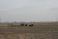
| American Bison. |
 |
| Red-winged Blackbird perched atop a Catty Nine Tail at Rod and Gun Club Pond. |
 |
| Bald Eagles nest. |
 |
| Gloria and Gary1 enjoy the view across Lake Ladora. |
Various marshes and ponds dotted the landscape as we continued on the 1.8 mi. Ladora Loop. Trail crossed a jeep or hard road a number of times as we meandered across the refuge. A number of short footbridges are strategically located to keep hikers from damaging fragile marsh and wetland habitats - except for the pond and lake all other low areas were dry.
 |
| Wetlands |
 |
| Which footprint is fresher? (boot or hoof) |
At the back side of the loop, there was a sighting of a Bald Eagle perched high in a cottonwood on the edge of Lake Ladora. An image not often seen by hikers.
 |
| CAUTION! DIP in trail ahead. What DIP? |
After completing the Ladora Loop, we took the Prairie Trail, .6 mi. to Rod and Gun Club Trail another 1.2 mi. to a wildlife viewing area at Rod and Gun Club Ponds. The site was littered with downed cottonwoods making it a nice spot for lunch.
 |
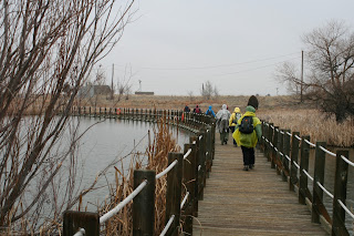
| Long pontoon footbridge crosses Lake Mary. |
The early afternoon was spent retracing our steps on Rod and Gun Club and Prairie Trail, which led us back to Legacy Trail and the TH. Within the final hour on trail, we stopped to don rain gear as the sky finally decided it was time to relieve itself. The result was a fine drizzle that barely made the ground change to a darker brown.
 |
| (L to R) Don and Melva Storm,Penny Geise, Marsha McBurnett, seated Barbara Peck, Maureen Bowles, kneeling, Kathy Macomber, Gloria Pittman, Vicki Eveland, and Bill Macomber |
After a brief rest period inside the Visitors Center, to make a pit stop, view the exhibits and gift shop, we returned to the bus for the short ride to the North Stapelton Commons for a hot cup of java at Starbucks or something cold from Cold Stone Creamery.
 |
| How many pairs of ears can you find in this image? (Find the answer at the end of this journal entry.) |
Total miles = 8.2
Total elevation gain = 47'
Answer: 9
What you should know about next week!
Heil Valley Ranch
North Foothills Open Space
Hikers will be challenged by considerably more elevation gain (over 1,100') compared to week one. However, that physical challenge will be overshadowed by a more diverse landscape, including areas covered with Ponderosa Pine, two overlooks of the snow-capped Rockies, and old homestead ruins.
The Wapiti (Native American for Elk)Trail is popular with mountain bikers so be ready to give them the right-of-way in both directions. Be listening for a callout of "Bikers" either from the hike leader or the sweeper throughout the day.
There will be sections of trail littered with loose and exposed rock. Be prepared with sturdy boots/shoes...full toe bumpers are recommended for this hike. Also, there will be areas of old beetle kill where virtually all timber has been clear cut and stacked on huge piles to be burned. Be sure to bring sunscreen (SPF 30 or better) for any exposed skin. Don't forget to wear a hat. Canopy will be spotty due to the clear cut areas. About 50 to 60% max.
Trail miles will be about the same as last week...just over 8 miles. The TH is a few miles north of Boulder just off Route #36. There are restroom facilities at the TH.
Boulder has great options for post hike coffee and IC.
We last hiked Heil Valley Ranch in October, 2011. If you are interested check out the journal entry from that hike to get a better understanding of what is coming. Click on the year, then click on the month and look for 'Heil Valley Ranch.'

No comments:
Post a Comment