I 70 was clear and dry, all the way to the exit for Empire/Winter Park (CO Rt. # 40).
We made a quick stop for coffee in Empire before climbing to Berthoud Pass (11,316'), followed by the descent into the Fraser Valley. Surprisingly, the road on both the ascent and descent was clear and dry.
Neither of us had hiked this trail before so during the drive, we exchanged handwritten notes obtained from various web sources directing us to the TH. Lets just say, we were left a bit confused.
As we approached the Winter Park Ski Area entrance, we noticed a sign opposite the entrance saying, National Sports Center for the Disabled, Bonfils - Stanton Foundation Outdoor Center. There was no route number sign as we entered the parking area. No indication of a trail.
 |
| Trail begins to the right of this sign. |
At the sign, an area map made some references to our handwritten notes. Then a physical check of the area next to the sign resulted in location of a snow covered boardwalk. It was the TH at 9,084' el.
Snowshoes were secured and packs cinched firmly in place and on trail by just after 10:00 a.m. Trail was well used showing numerous boot and snowshoe tracks since the last snowfall. A random plant of one of my poles surprised me. It quickly was buried to the top of the second extension. That would indicate an estimated 18" to 24" on the ground.
 |
| Ed on trail. |
Jim Creek Trail runs parallel with...you guessed it, Jim Creek. The headwaters begin just below Parry Peak (13,391'), located Southeast of the TH, on the Continental Divide (Trail). The creek is frozen over and blanketed with a heavy layer of snow. We did hear running water one time within the first hour on trail.
 |
| Jim Creek Drainage is wide at the beginning. |
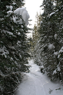
For the first hour, the area on both sides of trail was open but tree covered. We were aware of a full canopy of snow filled branches between 80 and 90% of the time. As the sun rose, there were dozens of faint thud sounds. It was the sound of buckets of snow hitting the snow on the ground.
 |
| Trail becomes narrow as slopes of dense pine close in. |
Trail meanders lazily along Jim Creek for about 3.5 miles before it becomes less of a defined path above treeline. We shoed an estimated 2.6 miles before stopping in a small open area surrounded by dense pine and spruce at 10,175' el.
At times we could see the ridge line of the Continental Divide above the trees lining trail. To the East was Rogers Pass (11,880'), and James Peak (13,294').
 |
| Ridge line of the Continental Divide. |
The spot Ed chose for lunch was in direct sunlight. It was a perfect setting.
When he arrived, he first compressed an area with his snowshoes. Using our external jackets as a moisture barrier and table cloth, we established a kitchen.
 |
| Our kitchen on the lower level. |
Without snowshoes on, our boots were consumed by the deep snow. Soon we were able to develop a lower level of packed snow from the bench we were sitting on. The lower level was perfect to set up the kitchen stove. Little to no wind meant no need for a wind screen today.
 |
| Ed enjoys a cup of hot tea. |
 |
| Strap on our snowshoes for the return trip. |
The Ramen Chicken broth soup was also a keeper.
 |
| A wonderful day in the Arapaho National Forest. |
We met three hikers from the East Coast with their dog and a woman hiking solo on trail before lunch. The balance of the day was quiet - except for that Army chopper overhead as we approached the TH around 3 p.m.
A wonderful day in the back country with a great friend.
Total mileage = 5.2 mi. RT
Total elevation gain = 1,091'
Topo Map = NG # 103 (Winter Park/Central City/Rollins Pass)

No comments:
Post a Comment