The ACAA van was ahead of my friend Curt and me as we approached the end of McGraw Ranch Road and the TH at 7,808' el.. I say ahead because Curt and me were in my vehicle so two other hikers could ride the van. In all, a record number 16 hikers set foot on trail today.
The TH is home to the McGraw Ranch Research Facility. The ranch, also known as Indian Head Ranch, was established in 1884 when Peter J. Pauley Jr. built a barn on the site. The Pauley family kept 2,500 head of cattle on 160 acres at the time.
 |
| Marker at junction of Bridal Veil Falls Trail and Black Canyon Trail. |
Today, research conducted on site includes elk studies, a butterfly inventory, rare plant studies, fire history, and glacier monitoring. Buildings are not open to the public.
Hikers enter through a gate at the main building, and pass by a number of small cabins used to house researchers.
 |
| Hikers on the way to the falls. |
After passing a privy, trail follows a west and northwest direction for just over three miles to the base of Bridal Veil Falls, tallest in the park at 8,865' el..
Trail parallels Cow Creek for the first mile, then crosses the stream a few times. Most crossings are by log.
 |
| Luisa crosses one of a number of log bridges. |
Soon trail enters a more dense forest and begins a gentle climb to the falls. Closer to the falls, trail becomes rocky. The last few tenths of a mile, hikers must negotiate a series of steep rock steps, some natural, others made by trail crews.
 |
| One of many photo ops along trail. |
If you enjoy a bit of a challenge on trail, this is the one for you. Not only are you required to negotiate a number of smooth boulders, some hand over foot climbing is required in order to get to the falls.
 |
| Chipmunks want to be your best buddy. |
 | ||||||||||||||||||||||||||||||||||||||||||||||||||||||||||||||||||||||||||||||||||||||||||||||||||||||||||||||||||||||||||||||||||||||||||||||||||||||||||||||||||||||||||||||||||||||||||||||||||||||||||||||||||
| A Stellar Jay stalks hikers looking for food. |
 |
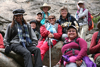
| Carried the wrong lens...so it's a three image group pic. |
If you are the adventurous type - many HCH members were - you can climb the exposed roots and rocks beside the falls to the top. Or stop at a number of spots along the way to pick a rock, sit and enjoy lunch or simply enjoy the setting.
Total miles = 6.4
Total elevation gain = 1,057'
Only two more hikes in the official hiking season. Next week we hike in Reynolds Park, outside Conifer.
The final week (Oct. 30th.), we hike the Cerain - St. Vrain Trail, close to Jamestown.
It's on Halloween. To those HCH members who are registered for that hike, consider it your one and only chance to dress in costume for a hike. Nothing restrictive or long flowing capes that may get caught on rocks or branches. Dress for the weather as a base layer and dress for Halloween as the outer layer. Face paint can take the place of a mask. Be creative. Think about it...the group photo will be a keeper. It will be a fun day to end the season.


No comments:
Post a Comment